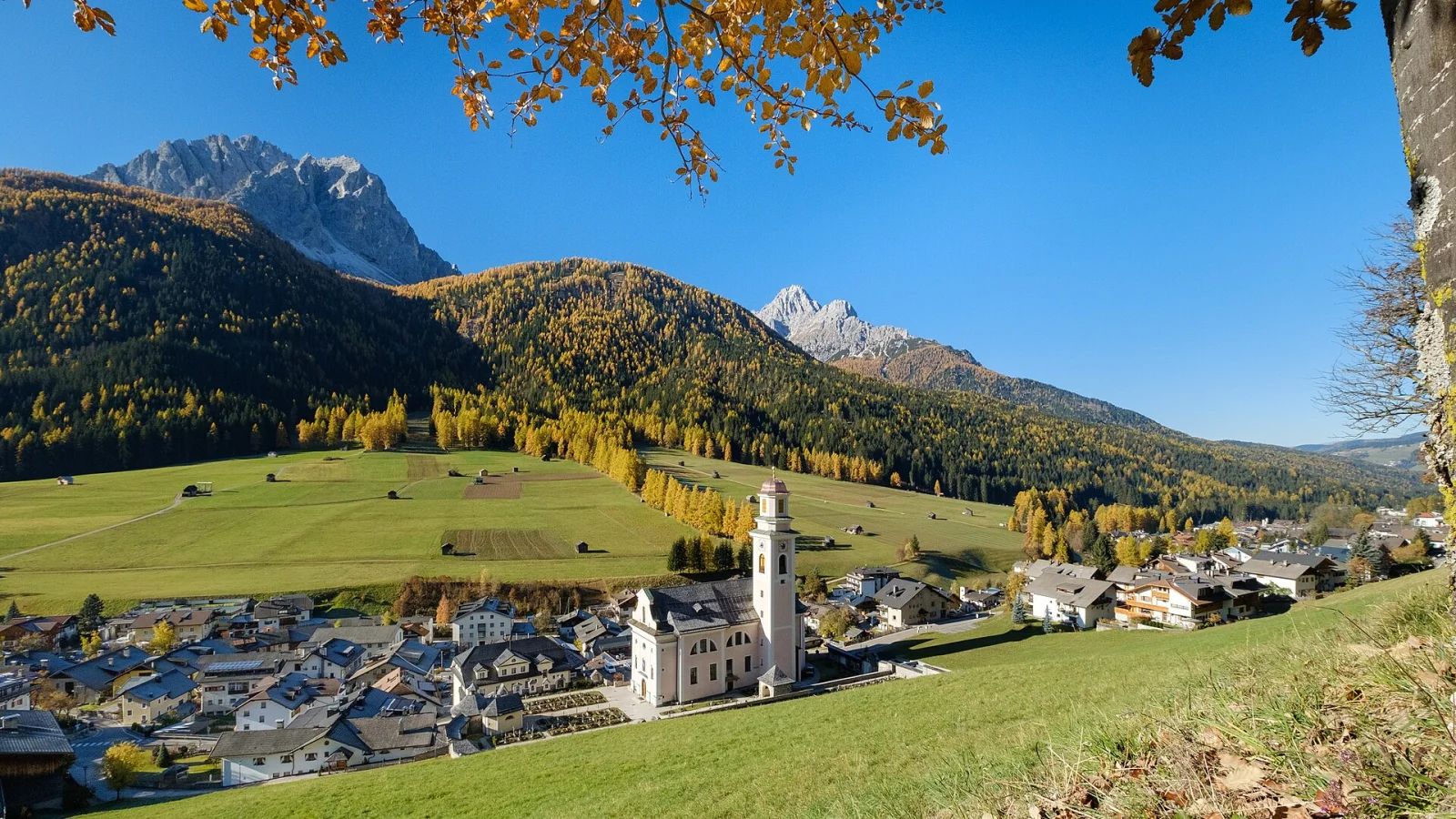
The name appears as Sexta in an imperial diploma of 965, then as Sextum in 1208, and it comes from the Latin ad horam sextam, at the sixth hour. The sixth hour, in Benedictine reckoning, is midday — and midday means south. It was the collegiate church of San Candido that used the expression, to say where this valley lay in relation to itself: the place of noon, that is the place to the south. The name of Sesto, in short, is a direction told by a clock. There would be another explanation, a sixth milestone on the Roman road that climbed from Littamum to the pass of Monte Croce di Comelico, but the first is likelier, not least because the name is essentially medieval. Beyond the name, little is left of the past of Sesto and of Moso, and there is a reason: in the First World War both villages were almost completely destroyed by Italian shells. Sesto lies beyond the Alpine watershed — the stream that crosses it flows into the Drava at San Candido, and the Drava into the Danube — and it is the easternmost comune of the region.
When the war broke out, there was one company of reservists to defend the village. The two armies fought for the peaks above it: the Croda Rossa di Sesto, monte Covolo, the Tre Cime di Lavaredo, monte Paterno; and among those who distinguished themselves in that fighting was an alpine guide from here, Sepp Innerkofler, whose flying patrol gave the Italian troops a great deal of trouble. The civilian population was evacuated, and Sesto is the only German-speaking village on the Italian border to which that happened. At the end of the war it was the place that had suffered the greatest damage in the whole of southern Tyrol: besides the village being almost entirely destroyed, fifty-four people had died, four in every hundred inhabitants. In November 1918 the Italian troops came down from the pass of Monte Croce di Comelico and entered the village. If the terms of the Paris peace conference had been applied to the letter, Sesto should have stayed with Austria, since it lies east of the Sella di Dobbiaco, which is the physical border and the watershed; it did not turn out so, and within two years the village passed under Italian sovereignty. Under fascism the border was fortified here as elsewhere: at the pass of Monte Croce the bunkers of the Alpine Wall are still there. On the twenty-seventh of August 1965 some men of the Befreiungsausschuss Südtirol opened fire with machine guns on the carabinieri barracks of Sesto and killed two carabinieri, Palmerio Ariu and Luigi De Gennaro. The arms of the comune — three silver mountains for the Tre Cime, with a black chamois climbing the middle one — were formally granted in 1972, but they are older than that: the same design had hung above the door of the town hall since the end of the First World War, and it is attributed to the painter Albert Stolz, who also frescoed the parish church. That church, first built at the end of the twelve hundreds and rebuilt more than once, stands today in the form given it in 1824. And the mountain still comes down: on the twelfth of October 2007 a landslide of enormous size fell from Cima Una, without victims, and another came down the same face four years later.
Straight-line distances from the town centre. Tap a point to open its page.
Near Sesto
The closest destinations covered by our editors, with straight-line distance.


Places to see within 25 km
Outside Sesto, but an easy day trip away.